

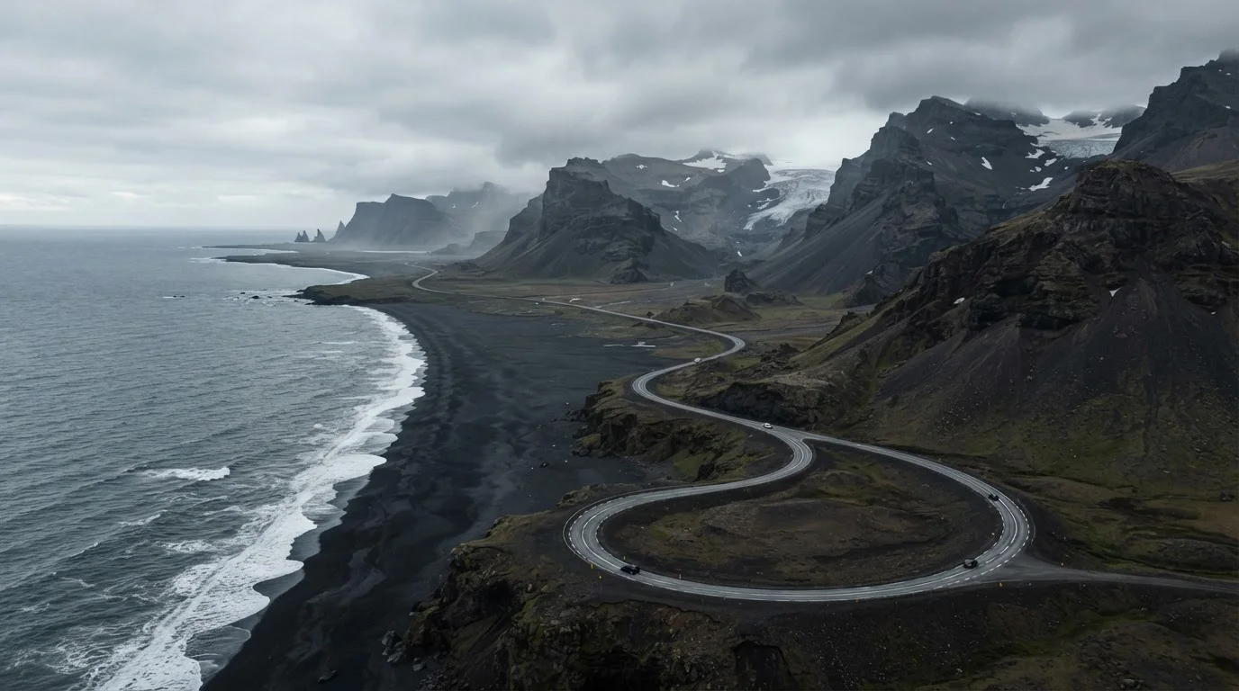
What Route 1 actually is
Iceland's Ring Road, officially Route 1, is a single paved highway that loops around the entire island. The total distance is approximately 828 miles (1,332 kilometers), though the exact figure varies slightly depending on which branch roads and detours a driver takes. Route 1 does not cut through the interior highlands; it follows the coastline and accessible lowland areas, leaving the Icelandic interior to F-roads that require four-wheel-drive vehicles and are closed most of the year.
The road connects Reykjavik in the southwest to every major populated region on the island. Drivers can travel it clockwise or counterclockwise. Completing the full loop in one continuous trip typically means passing through eight geographic regions, each with distinct terrain, weather patterns, and points of interest.
Regions the road passes through
Starting from Reykjavik and heading east, Route 1 first crosses the Southern Region (Suðurland), where it passes the Seljalandsfoss and Skogafoss waterfalls, the town of Vik, and the black sand beaches of Reynisfjara. The road then enters the East Fjords (Austurland), a section characterized by narrow coastal inlets and small fishing villages. This stretch is one of the most scenic and also one of the most time-consuming because the road curves tightly around each fjord.
Continuing north, the road moves through Northeast Iceland (Norðurland eystra), passing the Myvatn lake district, geothermal fields, and the town of Akureyri, Iceland's second largest city. The North (Norðurland vestra) and Westfjords junction follow, though the Westfjords themselves require a separate detour off Route 1. The road then curves back west through the Snaefellsnes Peninsula access points and into the Capital Region, completing the loop.
If you are already thinking about how to structure this as a longer road trip, road trip planning resources can help you map out overnight stops and vehicle needs before you commit to a direction.
Seasonal conditions and road access
Route 1 is paved and open year-round, but conditions change considerably by season. Summer (June through August) offers long daylight hours and generally stable roads, which is why most visitors choose this window. Spring and autumn bring unpredictable weather and the possibility of snow at higher elevations. Winter driving on Route 1 can involve ice, wind, reduced visibility, and shorter operational hours for gas stations and services.
The Icelandic Road and Coastal Administration maintains a public road conditions website where drivers can check closures and weather-related restrictions in real time before and during travel. Checking it daily is standard practice for anyone driving in winter or shoulder season. Some sections of Route 1, particularly in the East Fjords and north, are more exposed to storm conditions and can see temporary closures.
Rental vehicles with studded tires are available during winter months and widely used. Verify with the rental provider what conditions your contract covers and what is required by Icelandic law for winter tires during your travel dates.
Realistic timelines for driving the loop
Seven to ten days is the range most frequently cited by Iceland tourism sources for completing the full loop without feeling rushed, though the right number depends on how many stops a traveler wants to make. A seven-day trip covers the road itself with one or two stops per region. Ten to fourteen days allows for side trips, hiking, whale watching in Husavik, or exploring the Snaefellsnes Peninsula without doubling back on Route 1 proper.
Driving the loop non-stop is technically possible in around 17 to 20 hours of pure drive time, but Iceland's speed limits are low (90 km/h on paved roads, 80 km/h on gravel), road conditions vary, and single-lane bridges appear regularly, particularly in the east. Planning around driving time alone will leave most travelers frustrated. A more practical approach is to plan no more than 3 to 4 hours of driving on any given day so that stops feel intentional rather than squeezed.
Route 1
The official designation for Iceland's Ring Road, a paved national highway that circumnavigates the island. It is the primary long-distance road in the country.
F-roads
Unpaved highland roads in Iceland that require four-wheel-drive vehicles. They are closed during winter and parts of spring, and driving a standard vehicle on them can void a rental contract.
East Fjords
A region of eastern Iceland (Austurland) where the coastline is broken into deep narrow inlets. Route 1 curves around each fjord, making this section slower to drive than the distance suggests.
Studded tires
Winter tires fitted with small metal studs that grip icy road surfaces. They are permitted and commonly used on Icelandic roads during winter months; local regulations specify when they are required.
Practical details before you go
Gas stations along Route 1 can be spaced 50 or more miles apart in eastern and northern sections. Filling the tank before entering sparsely populated stretches is standard practice. Most stations accept major credit cards, though some smaller ones in rural areas have had issues with foreign cards, so carrying a backup option is sensible.
All visitors to Iceland should verify current entry requirements, including any visa or travel authorization requirements applicable to U.S. passport holders, through the Icelandic Directorate of Immigration or the U.S. Embassy in Reykjavik before travel. Travel advisories and local safety recommendations, particularly around coastal cliff areas and geothermal zones, are issued by the Icelandic government and are worth reviewing.
Iceland uses Icelandic kronas (ISK). Credit cards are widely accepted, but knowing the approximate exchange rate before arriving helps with budget planning. Accommodation along Route 1 ranges from guesthouses and farm stays to larger hotels in Akureyri and Reykjavik; booking well in advance is advisable for summer travel.